The search for the 17th-century burial ground at Ferryland was conducted in 2016 and is ongoing for the 2017 field season as a part of my Masters research at Memorial University. Prior to fieldwork, I surveyed spatial relationships between burial grounds and their associated settlements on the east coast of the U.S.A. and Newfoundland; where the burials were placed in the town, were they on a hill, were they beside a church, etc. The survey covered 43 settlements in the eastern U.S.A and 20 in eastern Newfoundland, and statistical analysis provided frequency of location information on the positioning of burial grounds in settlements with similar characteristics. For example, prior to 1640, 57% of fortified towns kept their burials inside the town walls, rather than outside. This information was applied to Ferryland, in an attempt to locate the burial ground associated with the 17th-century settlement. Guided by results of the statistical frequency model, a 6-week excavation was planned to investigate previously unexcavated elevated areas to the direct south and east of the enclosed settlement area as these locations were statistically the most likely areas outside of the fortifications for a burial ground to be placed.
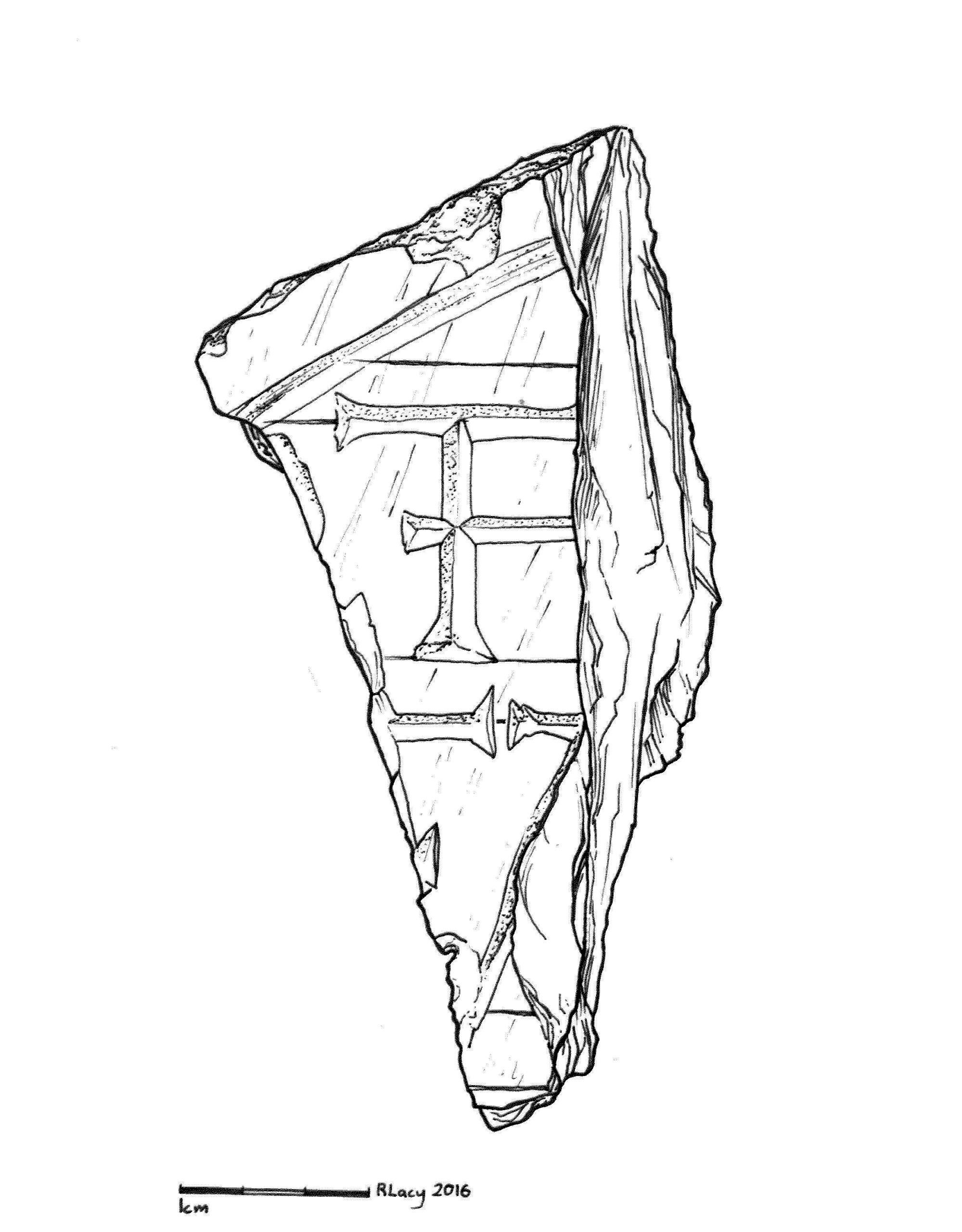
Illustration of one of the gravestone fragments previously uncovered.
The team was made up of archaeology students, community members, and volunteers from other disciplines with an interest in my research. It was exciting to get to work with so many excellent people from different walks of life! Before excavations began, Maria Lear, Archaeological Curator at the Archaeology Department, MUN, and I conducted a ground-penetrating radar (GPR) survey of 4 high-potential areas with the help of several volunteers. The GPR sends radar pulses through the ground in order to create a map of the subsurface. Where the radar pulses bounce off denser material, such as rocks or old stone walls, hyberbolic arches indicating something in the subsurface or a dip in the soil layer will appear to show that there might be something interesting below our feet. The survey, which took place over 3 days in May/June 2016, yielded interesting results with several readings which were flagged for later excavation due to their depth, shape, and size. Test trenches and units were planned using the GPR results as a guide. The trenches were all planned running north to south, to increase the likelihood of crosscutting a grave shaft, which generally run east to west in the Christian tradition.
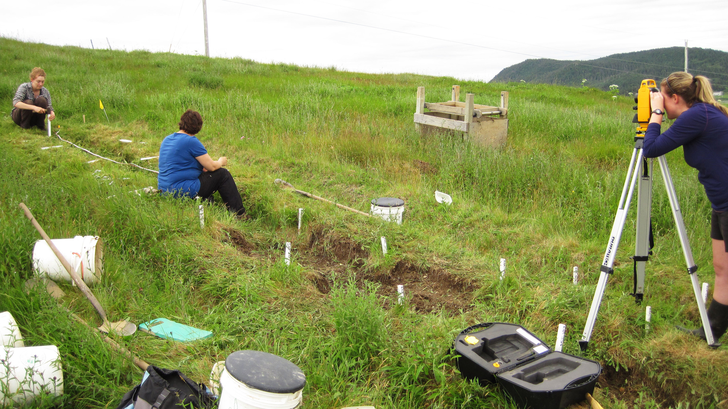
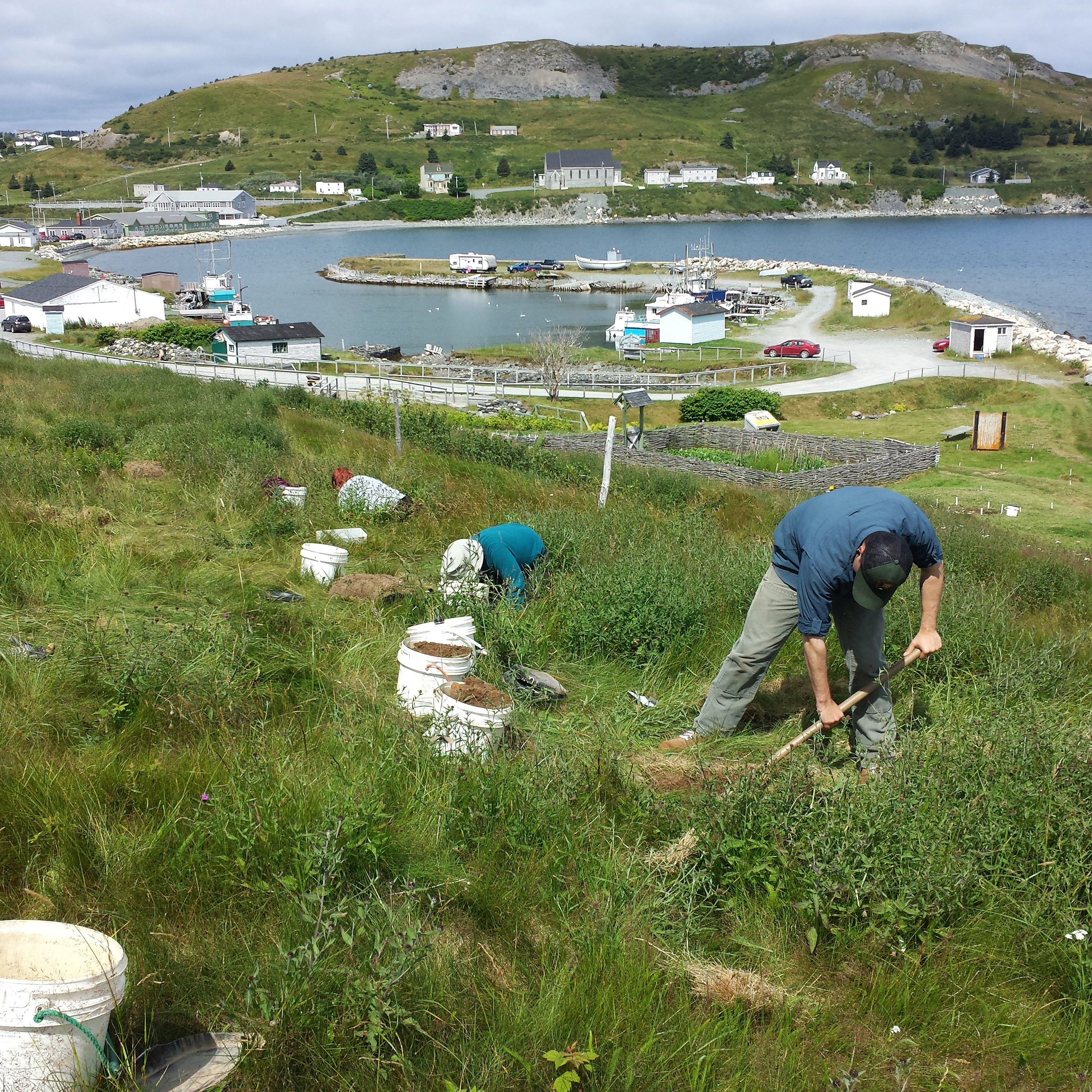
Surveying an area south of the settlement for excavation.
During the first week of excavation a number of 17th-century artifacts were uncovered, including two intact pipe bowls just above a large posthole and post mould which were still visible in the glacial sub-soil. This feature was created when a hole was dug and a post placed inside, then filled back in, and eventually the post rotted in place, creating a more organic centre and lots of loose gravel around it. This is visible in the subsoil, laid down by glaciers thousands of years ago, because the soil above has been plowed for gardens over the last 300 years. The only way you can see features like a post hold, or a grave shaft in these kinds of areas are if you dig down to glacial subsoil, which would only be disturbed by humans if they were digging something fairly deep. In the second trench, two features in a clay deposit which appeared to be candidates for grave shafts were identified. Unfortunately upon digging further I encountered an antifreeze bottle at approximately 95 cmbs, confirming that these features were a modern disturbance. These two trenches were dug in the field between the kitchen garden and defensive ditch, nixing the popular idea that the burials were located in that area.

Two 17th-century pipes found during the first week of excavation.
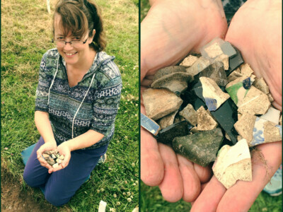
Over the second and third weeks, excavation took place on the hill to the south of the settlement. The first trench was located at the terrace edge directly west of the bastion earthwork which overlooks the settlement. When, at 90 cmbs, no graves nor subsoil had been encountered, the area started to seem interesting for other reasons. Along the trench walls on the north end, nearest to the hill slope, layers of black organic material were visible in the profile. Dr. Gaulton identified these as decomposed sod layers, and it was determined that the trench positively identified the southern defensive ditch and associated earthen rampart, the location of which was previously unknown. This also meant that the entire crest of the landform should be devoid of graves. In the ditch backfill, an inscribed stone was recovered by Tiffany Brazil, a MUN student volunteer, which could be a portion of another gravestone.

Drawing the soil profile of the southern defensive ditch.
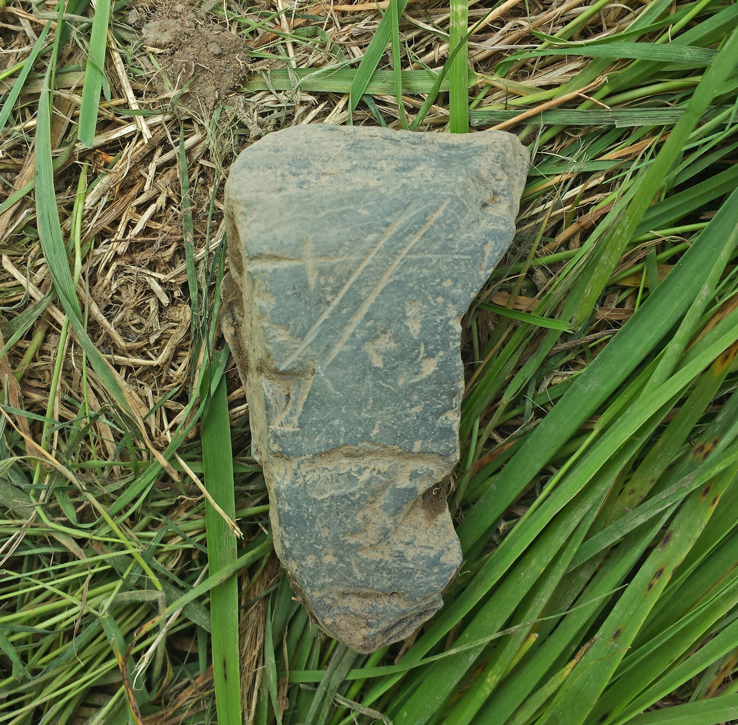
Inscribed stone found by Tiffany Brazil.
On the fourth week, several 50cm wide trenches were open up to the southeast of the kitchen garden, where we found a 15 cm thick layer of slate, possibly indicating a potential slate-working area nearby due to the volume of worked slate and broken roof tiles. The slate pile seemed to head towards the east into an unexcavated area. Two large postholes were also identified in this area, very close together, but with no others being found, it is unclear what such large posts could have been for.

Dr. Barry Gaulton photographing excavations during week four.
Completing those trenches at the beginning of week five, we moved up the hill, south and southeast of the well, to complete a series of test pits in order to check the depth of subsoil before a back hoe arrived. During these tests, an intact 17th-century soil layer was discovered on the Downs, yielding burnt stones, clay pipes, stoneware, and North Italian Marbled Slipware in wonderful condition. This area will be further explored in 2017.
Digging test pits.
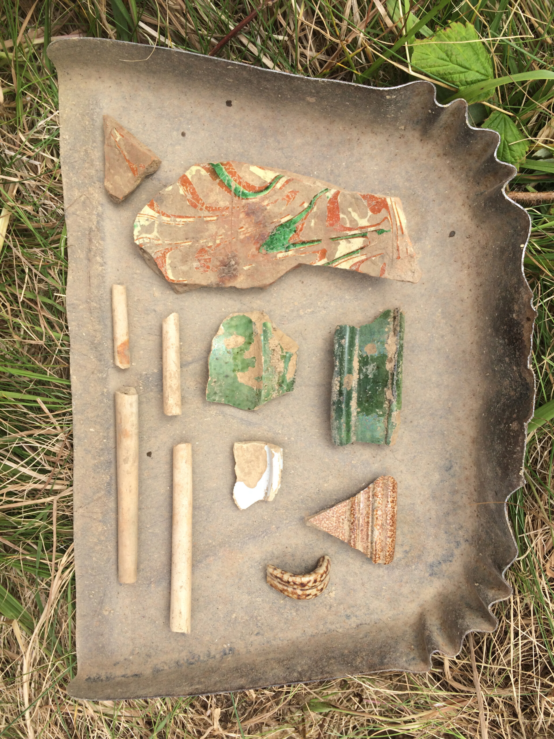
17th century artifacts: North Italian marbled slipware, Saintonge coarse earthenware, Bellarmine stoneware, tin-glazed earthernware, and pipe stem fragments.
At the end of week five, the back-hoe arrived and 8 trenches were dug in the test-pit areas, which were trowelled down to subsoil in week six. Although none of these trenches revealed human graves, it came with the added bonus of locating a large 18th-century cellar that was previously unknown.
Excavating test trenches with a back hoe.
While the 2016 excavation did not identify the early 17th-century burial ground, myself and a team of volunteers will be returning to Ferryland for four weeks in the summer of 2017 in order to excavate a high potential area near the brew house and inside the fortifications, close to where the several identified gravestone fragments were found in previous field seasons. Unfortunately this area was not included in the 2016 season due to the time constraints, and was pushed to 2017 in order to allot adequate time to deal with the 18th-century overburden. Within the fortifications and near the center of the settlement was deemed the most likely location statistically by the frequency model.

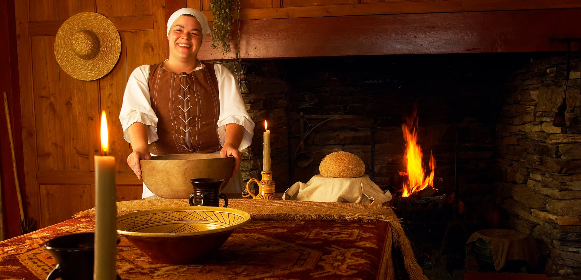
Robyn Lacy.
MUN Archaeology Graduate Student